Volcano Route Guided Hike
Set off on an unforgettable self-guided hike of La Palma's Volcano Route and be mesmerised by one of the island’s most magical natural settings. You'll learn all about the land of the volcanoes!. Hike Details.
- 7 hours
- 46 reviews
- Open on Wed
Set off on an unforgettable self-guided hike of La Palma's Volcano Route and be mesmerised by one of the island’s most magical natural settings. You'll learn all about the land of the volcanoes!
Hike Details
At the time indicated, we'll pick you up from the meeting point you choose to start this activity. During the hiking route, we'll cover a total of 17 km (10.5 miles). Ready? Let's go!
Firstly, we'll head to El Pilar Refuge, a resting area at 1,450 metres (4,760 feet) above sea level. This is the best spot to start this volcano hiking route in La Palma. So, what are you waiting for?
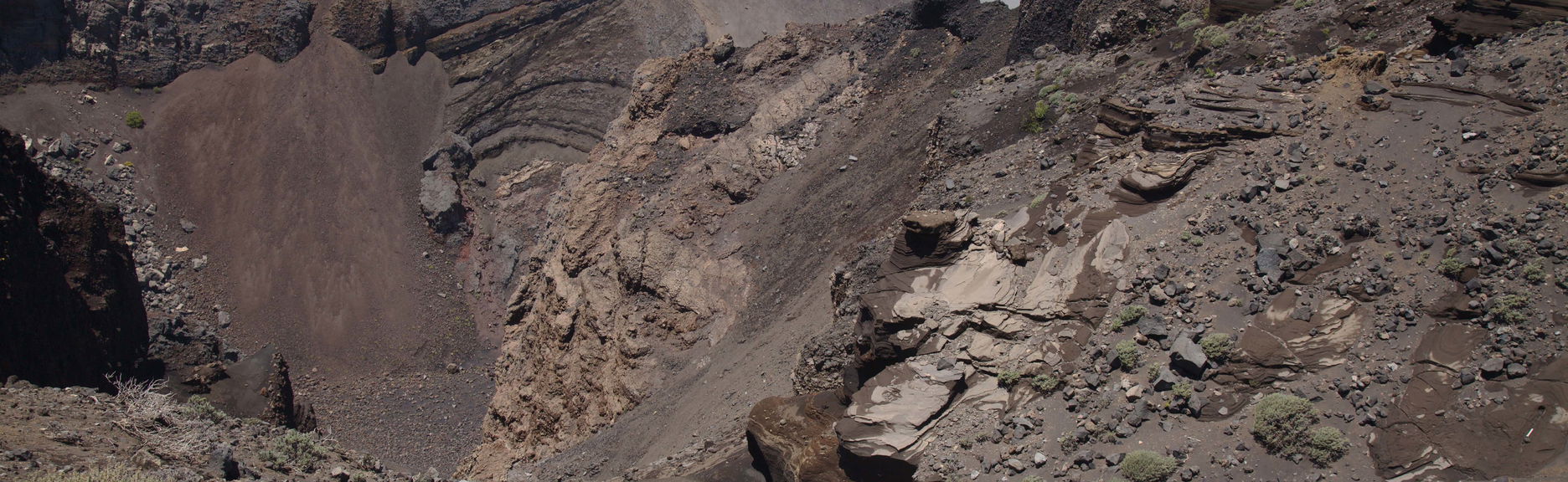
Along the way, we'll discover the island's volcanic history as we pass through ancient lava fields and spot ash and volcanic cauldrons from volcanic eruptions that have shaped the Canary Islands. We'll cross the newest part of the island, formed of several volcanoes that form part of the Cumbre Vieja Natural Park.
We'll go around Birigoyo Mountain, an old volcanic cone. The hike up will reward us with incredible views of the Valley of Aridane, the Caldera de Taburiente and in the distance the Roque de Los Muchachos, the highest point on the island of La Palma. Don't forget your camera!
Next, we'll continue hiking around volcanic lands where you can't miss the red and black tones on the ground. We'll spot the San Juan Volcano, the Hoyo Negro crater and Las Deseadas. You'll fall in love with the views!
Afterwards, we'll start heading down to Los Canarios, in Fuencaliente. Nearby, we'll find the Martín Volcano, with curious colours and formations, making it one of the most iconic on the island.
Finally, we'll head back to the starting point, where we'll arrive approximately 7 hours after the start of the activity.
Pickup Points
Pickup is included from the following meeting points:
At 7:45 am at the Hotel Princess in FuencalienteAt 8:15 am at the Plaza de la Constitución bus stopAt 8:30 am at the Meliá La Palma in Puerto NaosAt 8:30 am at the Centro Cancajos bus stopAt 8:35 am at the Farmacia de Cancajos bus stopAt 8:45 am at the bus station in Los Llanos de Aridane
HOW DOES IT WORK?
During this self-guided hike, you will embark on an immersive exploration of La Palma's volcanic landscape. Starting at your chosen pickup point, the experience begins with transportation to El Pilar Refuge. From there, you will navigate a 17 km hiking route at your own pace.
Included: Transport to and from the meeting point, experienced guide available for questions during the hike, and a detailed map of the route.
Not Included: Meals, drinks, or personal equipment.
The meeting points for pickup are predetermined, and you'll receive clear instructions regarding your selected location. Be ready to immerse yourself in the stunning scenery and learn about the unique geology of the island throughout the hike!
Prices
Included
- Transport by bus
- English–speaking guide
- Hiking poles
Tips
- Accessibility: Not wheelchair accessible.