Volcano Route Guided Hike
- 7 Stunden
- 44 Bewertungen
- Geöffnet am Mi
Set off on a self-guided hike of La Palma's Volcano Route and explore the island’s volcanic landscape.
Hike Details
At the scheduled time, we will pick you up from your chosen meeting point to start the activity. The hiking route covers a total of 17 km (10.5 miles).
Our first stop will be the El Pilar Refuge at 1,450 metres (4,760 feet). This is the ideal starting point for the volcano hiking route in La Palma.
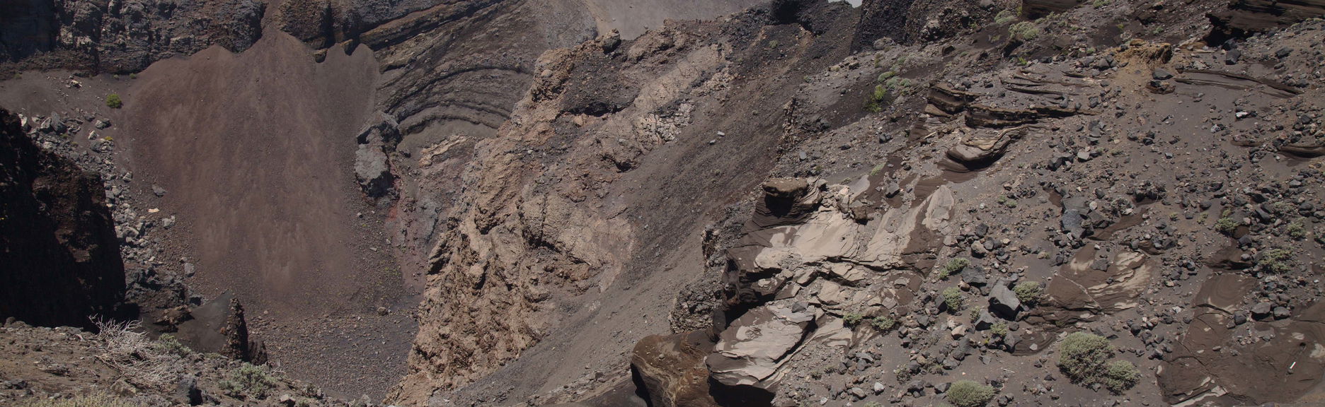
During the hike, we will learn about the island's volcanic history while navigating ancient lava fields and observing volcanic features shaped by eruptions. The route passes through the Cumbre Vieja Natural Park, featuring the newest volcanic formations.
We will hike around Birigoyo Mountain, an ancient volcanic cone, offering views of the Valley of Aridane, Caldera de Taburiente, and Roque de Los Muchachos, the island's highest point.
The hike will continue through volcanic terrain characterized by red and black colors, where we will see San Juan Volcano, Hoyo Negro crater, and Las Deseadas.
We will then descend to Los Canarios in Fuencaliente, close to the iconic Martín Volcano. We anticipate returning to the starting point approximately 7 hours after beginning the hike.
Pickup Points
Pickup is included from the following locations:
7:45 am at Hotel Princess in Fuencaliente8:15 am at Plaza de la Constitución bus stop8:30 am at Meliá La Palma in Puerto Naos8:30 am at Centro Cancajos bus stop8:35 am at Farmacia de Cancajos bus stop8:45 am at the bus station in Los Llanos de Aridane
Preise
Inklusive
- Transport by bus
- English–speaking guide
- Hiking poles
Tipps
- Accessibility: Not wheelchair accessible.